How To Use STALK-IT
STALK-IT has been designed to improve communication, awareness and coordination during modern deer stalking operations. These practical guides explain how different features can be used in real-world stalking situations to improve both strategic awareness and operational safety in the field.
How to Coordinate Multiple Stalkers Across the Same Ground
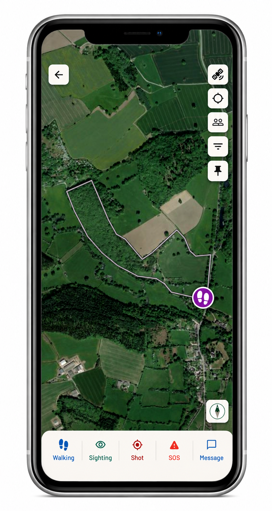
When several rifles are operating across the same estate or woodland block, maintaining awareness of who is where becomes increasingly important. Traditional methods such as phone calls, WhatsApp messages and dropped pins can quickly become unclear or out of date during active stalking.
STALK-IT allows all authorised users to view active stalkers on a shared live map, helping improve coordination and reduce uncertainty across the ground.
Strategically, this allows estate managers and stalking teams to understand how pressure is moving across the ground and where activity is taking place. From a safety perspective, it helps improve awareness between stalkers operating nearby.
Using the feature:
- Create a new stalk session
- Invite authorised stalkers to join the session
- View active locations and live status updates on the shared map
- Use shot markers and sightings to improve operational awareness
How to Use Shared Maps for Better Deer Management
Saveable shared maps allow teams to build long-term awareness of deer movement, pressure points, feeding areas and activity patterns across the estate.
Rather than starting from scratch during every stalk, STALK-IT allows users to work from a consistent shared operational picture.
This can help improve strategic planning, communication between stalkers and overall deer management efficiency across larger areas of ground.
Using the feature:
- Create and save estate or permission maps
- Mark useful locations and access points
- Save sightings and activity areas over time
- Reuse maps across future stalking sessions
How to Use Shot Markers & Shot Site Pins
Shot markers and shot site pin drops provide valuable awareness during active stalking sessions, particularly when multiple stalkers are operating nearby.
Quickly recording shot locations helps other users understand where activity has taken place while also assisting with follow-up, carcass recovery and operational coordination.
Strategically, recorded shot activity can help build a clearer understanding of deer movement and pressure patterns across the ground.
Using the feature:
- Drop a shot marker directly onto the map
- Add an exact shot site pin if required
- Share the location instantly with other authorised users
- Use markers to assist with follow-up and recovery
How to Track Deer Movement Using Sightings
Sighting pins and directional indicators allow users to quickly record deer activity directly onto the shared map.
Over time, these sightings help build valuable intelligence about movement corridors, feeding areas and behavioural patterns across the estate.
For stalking teams, this improves strategic planning and helps users make more informed decisions about how and where to approach the ground.
Using the feature:
- Add a sighting pin to the map
- Record species and direction of travel
- Share sightings instantly with other users
- Build long-term activity records over time
How Emergency Alerts Improve Lone Worker Awareness
Many stalkers spend long periods working alone in remote areas with limited communication.
STALK-IT includes emergency alert functionality designed to quickly notify other users if immediate communication or assistance may be required.
Combined with live stalker locations and status indicators, this helps provide an additional layer of operational awareness during lone working situations.
Using the feature:
- Trigger an emergency alert from within the app
- Notify active users instantly
- Share live location information automatically
- Improve response awareness across the ground